Home * Civil * Structural * Geotechnic * Site Survey & layout * Calcs * Contact & Links * Demo & Buy
Home * Civil * Structural * Geotechnic * Site Survey & layout * Calcs * Contact & Links * Demo & Buy | ||
Software for Civil, Structural & Geotechnic Engineers, Architects, Surveyors. | ||||||||||||
 | ||||||||||||
 | ||||||||||||
The new standard for surveyors and engineers. *Easy to learn *Standalone *Powerful integrated drawing tools *Cogo on the fly *Real world dimensionsDWG Ccompatible *PC or Macintosh
|  | |||||||||||
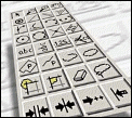
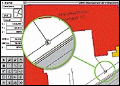
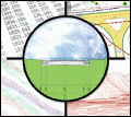
Pythagoras is Easy to Learn. Why? Because it works and thinks like a Land Surveyor. Powerful tools are right at your fingertips, all the time. The control panel acts like a dashboard in your car, displaying critical information. There is no need to memorize complicated line-commands. Everything is menu-driven. Pick and Choose. It's that simple. Pythagoras is a Complete Standalone solution for Land Surveyors and Civil Engineers. It contains every feature you will ever need. It is not piggy-backed on top of a complicated CAD application. Pythagoras includes a staggering amount of Specialized Drawing and Design tools. The control panel acts like a dashboard in your car, displaying critical information for any object. Move the cursor over a point, and instantly view its NEZ coordinates, Polar coordinates, point number, description or distance to other points. Move the cursor over a line, and instantly obtain its length, slope, bearing and more. The cursor even changes its shape, to indicate perpendicular points, tangent points, halfway points, and more. It's not just an ordinary cursor. It's an Intelligent Cursor! Pythagoras has all Cogo features you will ever need. Intersection, Resection, Open and Closed Traverses, Coordinate Transformations,you name it. More importantly, Pythagoras does Cogo in the background while-you-draw. Pythagoras accurately keeps track of the complete geometry of the drawing. All information you will ever need is derived from the geometry - coordinates, bearings, distances, slopes, angles. The geometry is a logical result of the drawing. It's always accurate, and it avoids mistakes. Pythagoras works with Real-world dimensions. It knows the real-world distance between points, the real-world radius of a curve, the real-world coordinates of points. The benefits are numerous. Do you have a drawing that was made in US feet, but now need to annotate in Meters? Simply change the Preference settings, and there you go. Two mouse clicks is all it takes. Pythagoras does not require you to start doing a complicated rescaling of your drawing to perform such a simple task. Pythagoras supports industry standard file formats. It reads and writes Pythagoras, DWG (including the latest AutoCAD 2002 format), DXF and ASCII file formats. Pythagoras runs on either PC or Macintosh. Both versions work exactly the same way, and both use the exact same file system. In a networked environment, computers using Microsoft Windows can work on the exact same drawing file as Macintosh computers connected to the same network. Or how about this scenario: While in the field, you use a Macintosh Powerbook. But when at the Office, you use a Microsoft Windows environment. No problem at all. Pythagoras uses the exact same file. It's the ultimate in flexibility!
|  | |||||||||||
Drawing & design tools. | ||||||||||||
 | ||||||||||||
Intelligent cursor. | ||||||||||||
 | ||||||||||||
Keep track | ||||||||||||